Apr. 25, 2019
Building high-definition maps for autonomous vehicles from space
-
-
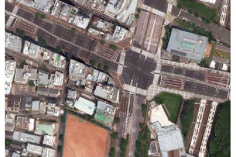
- Example of Tokyo region satellite image
-
-
-
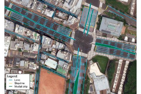
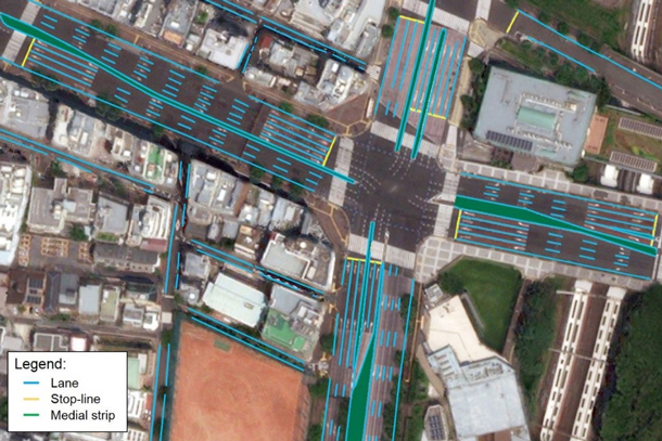
- Example of high definition map for automated driving
-
RELATED CONTENT
Apr. 25, 2019
TRI-AD, Maxar Technologies and NTT DATA collaborate to build high-definition maps for autonomous vehicles from space
Toyota Research Institute-Advanced Development, Inc. ("TRI-AD"), Toyota's automated driving software development company, Maxar Technologies Inc. ("Maxar"), a global technology innovator powering the new space economy, and NTT DATA Corporation ("NTT DATA"), a leading IT services provider, today announced they will collaborate on a proof of concept building automated high-definition ("HD") maps for autonomous vehicles using high-resolution satellite imagery. This is an important move toward advancing TRI-AD's open software platform concept known as Automated Mapping Platform ("AMP") and help realize the scalability of autonomous driving.