Toyota utilizes information to solve social issues and provide better products and services.
We use the information provided by our customers to improve the quality of our products and services, to provide information such as notifications, and to prevent unauthorized use through identification verification.
In order to provide safe services, we also pay careful attention to the handling of information.
We put privacy first and strive to provide products and services that please our customers.
Utilizing Data with Connected Services
Vehicle data enables us to grasp the state of customer's driving and the state of customer's vehicles.By reading and analyzing customer driving and vehicle conditions from the data, this system helps to improve driving experience and resolve vehicle problems, such as providing advice on driving and solving problems related to the vehicle.
In addition, the vehicle is equipped with various sensors, and by analyzing the sensor information, the environment in which the customer's vehicle has driven can be grasped.
Effective use of this information on the driving environment can help to solve social issues, for example, by helping to alleviate traffic congestion, or by efficiently grasping the deterioration of roads for repair.
Examples of Toyota's data utilization
Here are some examples of our efforts to create a "enriching the lives of communities" through the utilization of data.
Map of traveled roads
This service collects data on roads traveled by connected vehicles over the past 24 hours and displays on a map the roads that were accessible. It is particularly useful during disasters for identifying detours and confirming which roads have been restored.
-
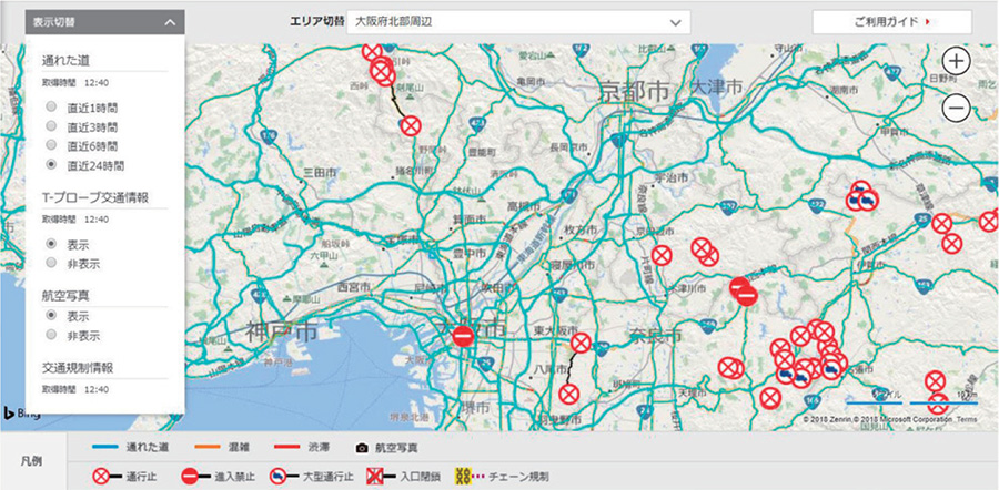
- Figure* This service is using Microsoft® Bing Maps® Enterprise licence. (This figure is from the 2018 Osaka Earthquake in Japan.)
RELATED CONTENT


MOST POPULAR